Back هتينغر Arabic هتينجر ARZ هتینقر، قوزئی داکوتا AZB Хетингер Bulgarian Hettinger Catalan Геттингер (Къилбаседа Дакота) CE Hettinger CEB Hettinger, Gogledd Dakota Welsh Hettinger (North Dakota) Danish Hettinger (Dakota del Norte) Spanish
Hettinger, North Dakota | |
|---|---|
 Hettinger | |
 Location of Hettinger, North Dakota | |
| Coordinates: 46°00′06″N 102°37′24″W / 46.00167°N 102.62333°W | |
| Country | United States |
| State | North Dakota |
| County | Adams |
| Founded | 1907 |
| Incorporated | 1908 |
| Government | |
| • Mayor | James Lindquist |
| Area | |
| • Total | 0.86 sq mi (2.22 km2) |
| • Land | 0.83 sq mi (2.15 km2) |
| • Water | 0.03 sq mi (0.08 km2) |
| Elevation | 2,740 ft (835 m) |
| Population | |
| • Total | 1,074 |
| • Estimate (2022)[4] | 1,029 |
| • Density | 1,295.54/sq mi (500.16/km2) |
| Time zone | UTC-7 (Mountain (MST)) |
| • Summer (DST) | UTC-6 (MDT) |
| ZIP code | 58639 |
| Area code | 701 |
| FIPS code | 38-37700 |
| GNIS feature ID | 1036091[2] |
| Highways | US 12, ND 8 |
| Website | hettingernd.com |
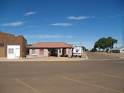
Hettinger (/ˈhɛtɪŋɡər/ HET-ing-gər) is a city in and the county seat[5] of Adams County, North Dakota, United States. The population was 1,074 at the 2020 census.[3]
North Dakota State University operates a livestock research station near Hettinger, which often partners with South Dakota State University's Antelope Range and Livestock Research Station for sheep research.[6]
- ^ "ArcGIS REST Services Directory". United States Census Bureau. Retrieved September 20, 2022.
- ^ a b U.S. Geological Survey Geographic Names Information System: Hettinger, North Dakota
- ^ a b "Explore Census Data". United States Census Bureau. Retrieved October 20, 2023.
- ^ Cite error: The named reference
USCensusEst2022was invoked but never defined (see the help page). - ^ "Find a County". National Association of Counties. Archived from the original on May 31, 2011. Retrieved June 7, 2011.
- ^ "Antelope Range and Livestock Research Station". South Dakota State University. Archived from the original on September 5, 2015. Retrieved January 27, 2015.